Making maps for Galimulator - the new and easier way
So after suffering with BitMapper for a long time, I've got some hopefully nice news for map makers in the Galimulator community. Starting with version 4.9 - which should be rolling out to a public beta soonish, you are able to make maps using nothing more than a single image file - or optionally several image files if you want to get fancy about it.
The main change is that the brightness of every pixel in the image now indicates how dense that particular region of space is. So if you create galay based on an image like this:
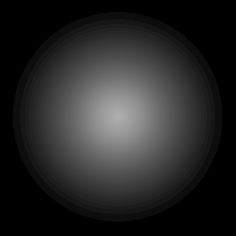
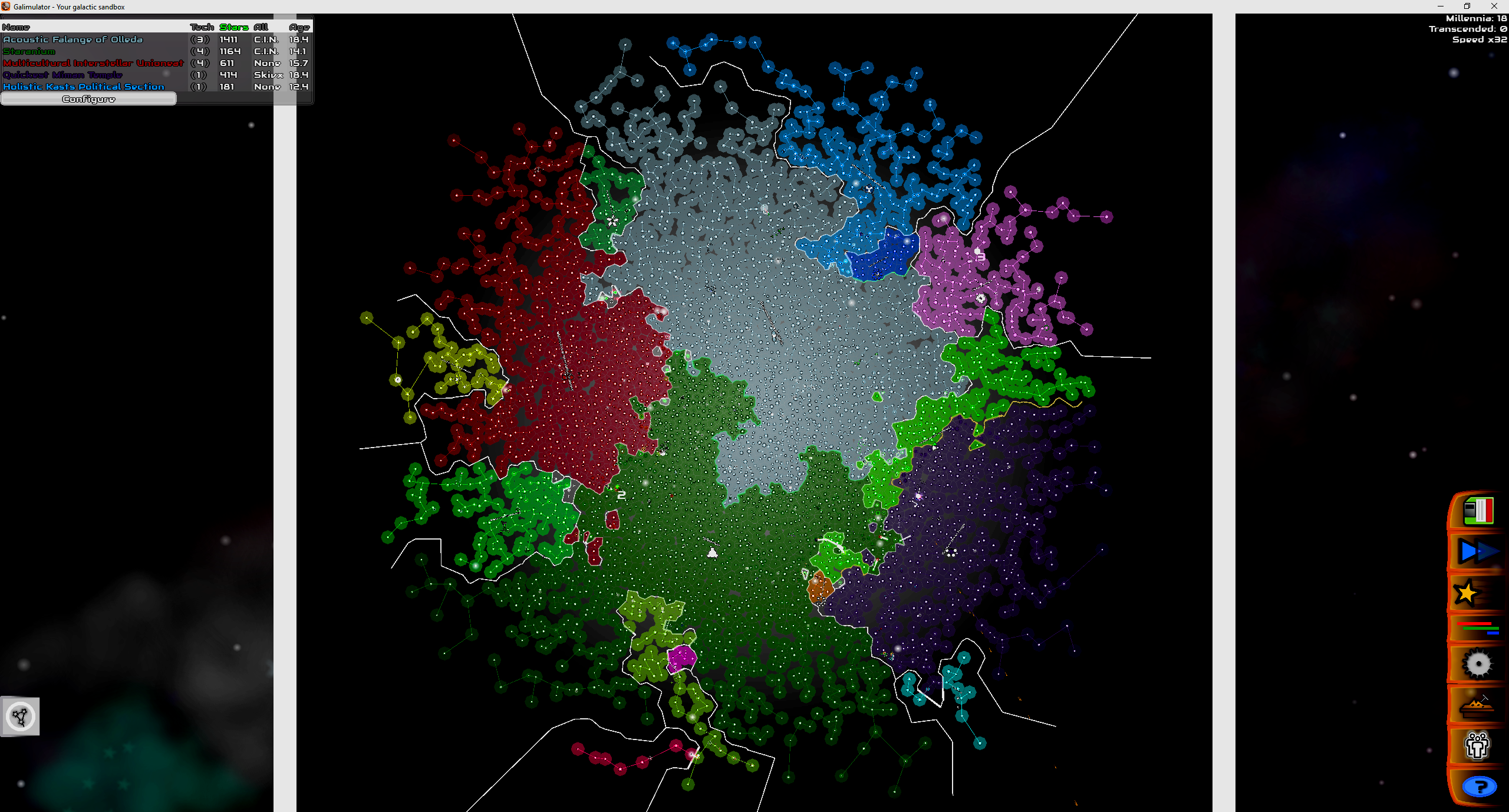
You will get a galaxy that looks something like this:
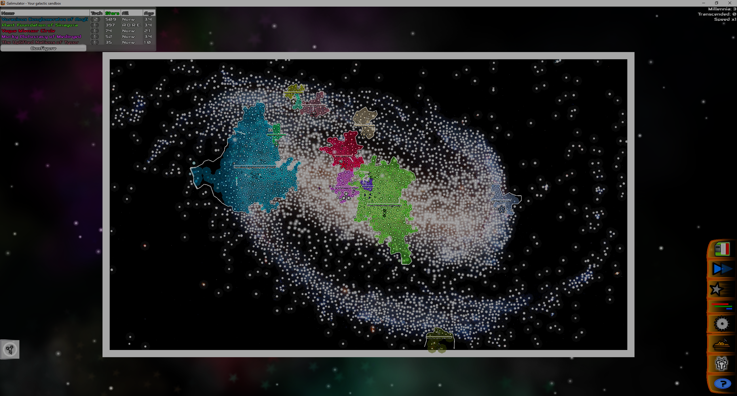
This can look particularly good with real galaxy images, for instance:
So, how to achieve all this? Read on!
Quickmaps
The easiest thing is simply to place your image file (png is recommended but other formats may work) in the assets/data/maps/quickmaps/ directory. Any files you place here will be automatically scanned by the game when it starts up - and they should be visible in the galaxy creation window.
When you load it up, you will notice that you can manually tweak the density adjustment scale. The higher this goes, the more tightly packed the stars will be - and the galaxy thus smaller or larger. Feel free to tweak this at your leisure.
Full map files
Now, quickmaps always have the density image in the background of the galaxy - and the default density set to 100. Perhaps you want to use a different background image, or you know that the density should be a certain value every time? If so, you may want to go ahead and create a full .map file for it and place it in assets/data/maps/.
This will allow you to tweak a bunch of stuff - in fact exactly the same stuff that was covered in the old article here: Creating your own Galimulator maps - but instead of using the rather obscure MapBitter system, you will specify your density image instead.
E.g:
name=Earth
density-file=earthdensity2.png
density-adjustment=500
background-image=decoratedearth.png
locations=earthcountries.merc
timenoun=Year
governments=earthgovs.json
So what is happening here is that we are specifying a density file, a default density adjustment and a background image. For the other properties, feel free to check out the old article, the location system is a bit of a tricky beast ...
Anyway, this file simply needs to live in assets/data/maps/ and the game should pick it up during start! Good luck, and come join us in the Discord server to share your creations!